Maeldune - Light on Maldon's Distant Past
Stephen P Nunn
WE have seen in the pages of this book that Maldon, or to give it its original name 'Maeldune', is essentially an Anglo-Saxon town. Early chronicles reveal that King Edward the Elder came here twice - firstly during the summer of 912 and again in 916, to supervise the construction of his mighty 'Burh' fortress. Faint outlines of Dark Age homes have also been revealed fronting the line of our present-day High Street and surviving silver coins indicate that Maldon had an operational mint, from the reign of Athelstan, right through to the 12th century.
Although a thousand years have passed since the town's fate was settled by axe and by sword at the bloody Battle of Maldon in 991, its underlying shape has changed very little and it is quite possible that at least part of the existing town boundary could be a remarkable 20th century survival of those 10th century roots. Admittedly there are no contemporary documents to confirm this theory, but there are important clues in both the famous Domesday Survey of 1086 and the lesser known Maldon Borough Royal Charter of 1171.
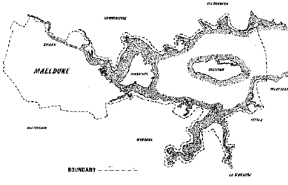
A section of the 1171 Charter reads; "Be it known....that I Henry, King of England,....do confirm to the Burgesses of Maldon....all their lands and possessions, and their tenements which they hold for me within and without the Borough, to the extent of the boundaries of the said Borough, namely Haylespitt, Morisbroc, Limborne, Billincbroc, Buherne, Cravenho and Elmcroft....".
The boundary, some 30 or so miles in circumference, begins near Stansgate Abbey Farm and follows the sea wall, skirting the parishes of Steeple - the Stepla, or 'steep place' of the Domesday; Mayland - 'land of stinking mayweed'; Mundon - literally 'Munda's Hill', whoever he was!; then to Limbourne or Limeborne Creek. From there it cuts across country, briefly joins Woodham Mortimer Brook - originally known as Billing Brook and earlier still as Billincbroc, and eventually arrives at Limebrook Farm.
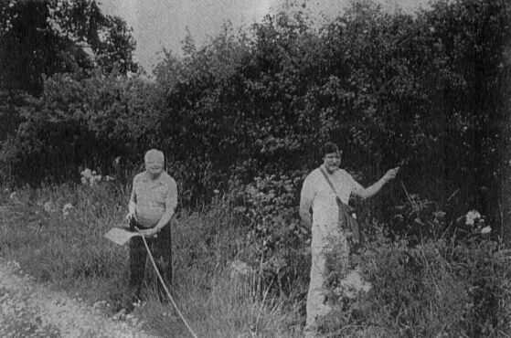
After traversing Spital Road it then runs alongside an early hedgerow. I describe it as "early" because it has been possible to roughly date the hedge by carrying out a survey of the number of plant species. Based on the principle that a new species roots itself every century, it is a staggering 600 years old!
The boundary then carries on through Wood Corner Grove, touches Bog Wood and a meandering stream, originally known as Morisbroc. It then arrives at the little hamlet of Beeleigh, once a clearing in the trees where bee hives were kept. Until the Reform Act was passed in 1832, it detoured Heybridge completely, flanked the north bank of the river, glimpsed the mysterious Barrow, or Borough Hills and ended in Gore Saltings, on the outskirts of the little saltwater village of Goldhanger.
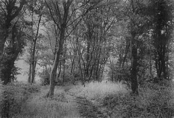
About 75% of the boundary is still public footpath today. Walk just a small stretch of it, as I did recently, and you will experience a kind of "time travel" back to the very origins of Maldon's past. Anyone can do it, all you need is a map, a bit of perseverance and you will uncover all the secret nooks and crannies of the landscape which we just pass by today but with which our forefathers were so familiar. Until about 100 years ago the bounds were still regularly beaten but this time honoured ceremony has, like so many other ancient local traditions, now also sadly disappeared. Maldon's landscape legacy is, however, still there, waiting for you to re-discover it and marking, in its timeless, almost secret way, a thousand years of our town's rich and colourful past.
| Mealdune Contents | Maldon Archaeological Reports Home | Acknowledgements.... |
Maldon Archaeological Group - 1998